The original plan for this project was to remove the existing fencing once the lambs had gone to pastures new in a few weeks time; we could even have coordinated the work to happen whilst Main Street/Wath Lane is temporarily closed to traffic for roadworks. The fence removal work was to be undertaken by Stuart Barton, who owns the field, supported by volunteers from the village. Clearly we can’t currently ask for volunteers to help with this activity at this time and so we will need to put the project on hold, possibly until this time next year.
We would like to say a big thank you to the volunteers who have been cutting the grass on both Staveley Village greens and on Spellow Crescent in the absence of our usual contractors Harrogate Borough Council (HBC). Also thanks to those who have been watering the new trees which were planted during the very wet winter.
HBC will not be in a position to provide a grass cutting service for some time yet so we have engaged another contractor to undertake the work for the time being. The new contractor will start week commencing 25th May 2020. It should be noted that they will only be cutting the grass on Parish Council land and not on HBC Housing land, which remains the responsibility of HBC.
The refurbishment of the phone box on Main Street that houses the community defibrillator is now complete. The work has taken longer than expected but the end result should see the K6 model box looking good for many years to come. Extremely wet weather at the start of the work and then the introduction of the Coronavirus restrictions meant that the contractor was only able to complete the work last week.
The phone box refurbishment work was part of the grant that the Parish Council received from the Allerton Park Landscape and Cultural Heritage Fund in 2019. Other projects completed from this grant were the tree works in the Jubilee Recreation Field, the Pinfold and the Village Green and the replacement gate for the Pinfold.
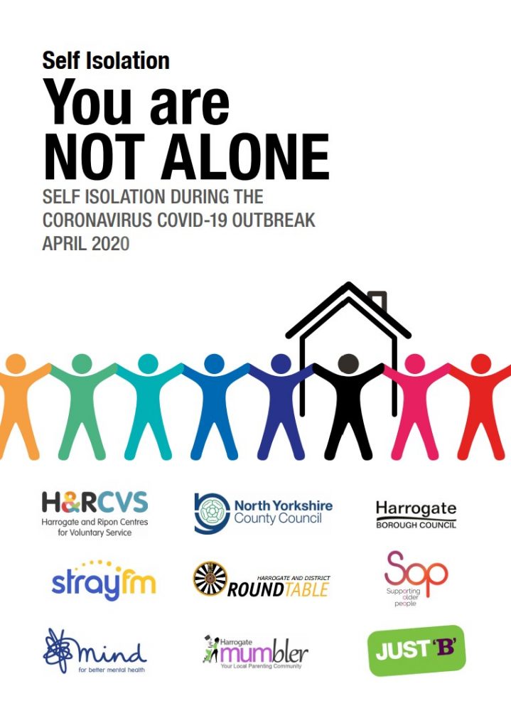
Harrogate Round Table has worked with Harrogate Borough Council, North Yorkshire County Council and trusted local charities to provide this helpful guide to local support available now in and around Harrogate. The information in this leaflet is to assist those people who are self isolating at home.
The Public Rights of Way Officer at North Yorkshire County Council has contacted the landowner regarding these illegal signs on the unsurfaced section of the unclassified road. Unfortunately, the Officer is unable to follow up the contact until the lockdown has been lifted. At the time of writing, the landowner has not yet responded.
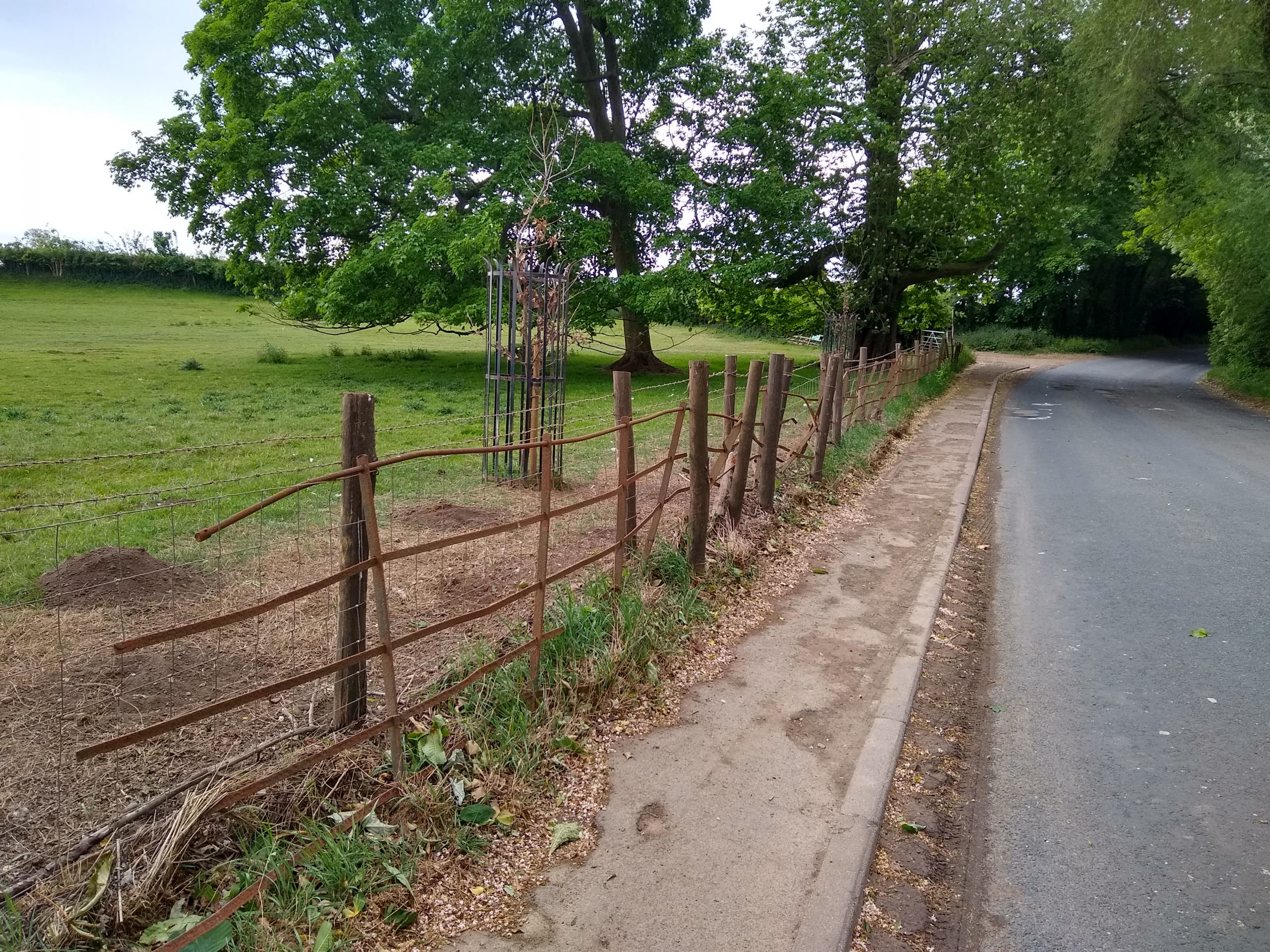
East end of Bedlam Lane where it meets footpath 15.124/8/1
Staveley residents, and dog-walkers in particular, may have seen the new signs that have appeared on and off Bedlam Lane. We have received a number of enquires about the new signs and would like to provide the following update on their status.
There are two sets of new signs:
in the field that links footpath 15.124/8/1 to Bedlam Lane and
This map is interactive. You can move and re-scale it using the various controls within the viewport.
Click/tap the map and drag to move the map around within the viewport as required.
Zoom in and out using the +- controls in the top left, pinch in/out or roll the mouse wheel when pointing within the map area.
Click/tap a marker, line or shape for further information in a popup window. If any marker, line or shape has an image, those images are displayed in a gallery at the bottom of the map. Select an image from the gallery and its marker will popup to indicate its location. The gallery is only displayed when one or more marker, line or shape with an image is within the map viewport.
Select the four corners icon in the top left to expand the map to full screen.
Select the tiles icon in the top right to select a different base map from the popup list. There are a number of base map options available.
Some maps also have layer switches that allow you to show or hide markers, lines or shapes. If a map has this feature, the layers and their switches are listed below the base maps. This feature enables markers, lines and shapes to be individually removed to make a map more readable.
Select the target icon in the bottom right to locate yourself with a marker. This feature will only work if your device has a GPS service and that service is currently active.
Can I download map data?
Yes. Select Details in the map header. A panel will overlay the right side of the map viewport, containing a file format drop-down list and a Download link. Select the required file format from the drop-down list and select the Download link. You will be prompted as to what you wish to do with the file.
The file will contain all of the waypoints for all of the currently visible markers, lines and shapes. You can control which markers, lines and shapes to include in the download file by switching the respective layers on or off. Select the tiles icon in the top right of the map viewport (close this panel first) to see the layers available below the list of base maps.
Whilst the panel is open, select More Details to display the map on a separate page. There is also an option to download map data on this page.
Close the panel by selecting the X in the top left corner of the panel.
The first set of signs on this informal path across the field are correct. Although the path has been used for many years by local residents, it is not a public right of way (PROW) and crosses private land.
The second set of signs on Bedlam Lane are less clear. Bedlam Lane itself is an unclassified road in two sections; section No. U8086/9/30 which is surfaced and section No. U8086/9/50 which is unsurfaced. It is private land and is not a PROW but is a public highway with public access, that could be subject to restrictions.
We have contacted North Yorkshire County Council (NYCC) Countryside Access Service and have been advised by the Public Rights of Way Officer that there are currently no legal restrictions on public access on any part of this route.
We have also contacted the landowner, the Spellow Estate, to request that at least during the current restrictions on public mobility that residents be able to use footpath 15.124/8/1 and Bedlam Lane as a circular walk. The landowner has cited the following case for the new signs:
“We have observed a significant increase in the number of walkers locally. As I’m sure you will appreciate, when the general public stray onto private property the landowner becomes liable for any accidents that could occur on their land.
The increased number of walkers straying from public footpaths onto private land, often with their dogs off the lead, has given us serious cause for concern. Not only are we liable for the walkers but also their dogs.
Following discussions with our insurer the signs have been put in place to safeguard the estate from legal action should an accident occur on our private land.“
We have asked the NYCC Public Rights of Way Officer to clarify the situation with the landowner.
The landowner is very aware that a clearly defined circuit for the village would be sensible and would welcome a discussion with the Parish Council on this once Covid-19 has passed. An item to this effect will be placed on the agenda of the next Parish Council meeting.
All the PROWs in the parish and more information about the PROW network can be seen on our Public Rights of Way page.
The following update for 31st Match 2020 has been distributed by Harrogate Borough Council (HBC) with regard to the support available during the coronavirus pandemic.
What extra help do you need?
The Harrogate district community has been outstanding over the last week and many have come together to set up schemes to assist their local residents.
We are aware that your parish/locality may need additional support and we would like to know how best we can help you. Please complete This questionnaire and press submit. We can’t make any promises but we will do our best to help in whatever way we can. We are working with partners and some of the information you provide will be shared to ensure those who need help get help.
We appreciate the situation is changing rapidly and we are trying to establish targeted help as quickly as possible across the Harrogate district. We therefore intend to send out this questionnaire on a regular basis to enable you to keep us updated.
We are contacting every household in order to set up a buddy scheme for the village. It is likely that some households will be required to “self isolate’ in the weeks ahead. The government has indicated that each household should be treated as a unit, i.e. when one occupant needs to isolate it is more effective if all occupants do the same.
To make this challenging compliance more manageable, in Staveley we could work together and have a plan to help anyone who might need assistance.
To prepare for this scheme, please could you email or telephone me stating your home address, a telephone number and/or email, and confirm whether you are likely to be in:
The ‘at risk group’ and want to be part of the buddy scheme to receive assistance,
Willing to help with the scheme by being a buddy, or
Have made your own arrangements and do not require a buddy at this stage.
We all know one thing about this situation and that is that it is changing hourly, if we have a clear communication link to every household in the community then hopefully we will be best placed to adapt as the goalposts move. In addition to the allocation of buddies there will be a central contact phone number and email so that when anyone’s situation changes plans can be amended.
CONTACT DETAILS email: helen.north@staveleyandcopgrovepc.org.uk or telephone 01423 340 650. Helen North
All Saint’s Church, Staveley is also offering Pastoral Support and assistance in doing shopping (and hopefully collecting prescriptions if we can arrange that with the Surgery). Revd Claire has issued the leaflet below.
The Church will be looking to find volunteers to do shopping which would be complimentary to the Parish Council initiative and the intention is to pool volunteers to deal with demand and have a coordinated response.
This event has been postponed until September 2020
This year’s Great British Spring Clean event will include a litter pick in Copgrove. The group is meeting at the postbox at the corner of St Mongah’s Lane by the Church at 10 am on Sunday 3rd May 2020. Please come along and lend a hand if you can. The event has full public liability insurance. Contact us if you require any further information.
Following our recent posts on dog fouling in the Parish, Keep Britain Tidy have launched their campaign to tackle this noxious problem.
Their latest research into Dog Fouling found that 15% of dog owners admit to letting their dog poop in a public place without picking up, leading to 76% of adults stepping in dog poop in their lifetime. The campaign features dogs as the messenger, appealing directly to dog lovers and leveraging the levers of both pride and shame to remind owners to pick-up their poop because it’s what their dog would want them to do.
The campaign has been designed to work across social media using highly engaging video content, and posters for placement at Dog Fouling hotspots in local areas. There are four videos available to choose from, featuring ‘Ben the Boxer’ as well as Sarah the Spaniel. The videos can also be voiced with a regional accent to really connect with residents.
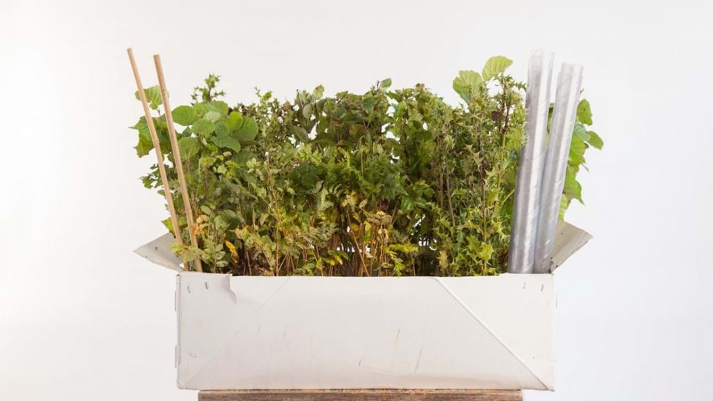
The Parish Council applied to the Woodland Trust, under their “Free Trees for Schools and Communities” scheme, for a 420 sapling pack of mixed species trees and the application has been succesful. The intention is to use the saplings to replace and infill in the hedges around the Jubilee Recreation Field in Arkendale Road. There may be some saplings available from the batch to infill as necessary in other hedgerows on our land.
The saplings will be available for planting out in November 2020. We will probably be seeking some assistance with the planting out from the community.
The scheme is open to schools and all kinds of different groups such as resident associations, sports clubs, scouts, guides and many more. You don’t need to be an official organisation. You could even set up a group for the purpose of planting, but you must be not-for-profit. The most important thing is that your group is willing to take on the planning, planting and care of the saplings. If you’re applying as a community group, the land needs to be accessible to the public. Follow the above link for further information.
Description: 2 signs indicating entry to Copgrove, 1 on Wath Lane and 1 on Apron Lane.
Estimated Value: £710
Acquisition: Purchased in November 2020 and installed in February 2021.
Locations:
Wath Lane – Grid Reference:
Apron Lane – Grid Reference:
Recreation Field
Description: Enclosed field of public open space with a fenced children’s play area and small football pitch.
Location: Arkendale Road, Staveley. Grid Reference: SE
Rented From: Staveley Relief in Need Charity Rental Fee: £70 per annum
Allotments
Description: 2 allotment plots leased annually to local residents.
Location: Arkendale Road, Staveley. Grid Reference: SE
Rented From: Harrogate Borough Council Rental Fee: £40 per annum per site Lease Agreement
Posts & Chains
Description: A row of posts and chains along the edge of the village green west and the unmade road in front of the Royal Oak pub, acting as a barrier to prevent car parking on the green.
Location: Village Green West, Main Street, Staveley. Grid Reference: SE 363 627
Acquisition
Date: Not known Cost: £665
Current Use: Boundary fence
Notice Boards
Description: 3 village notice boards at various locations around the two villages.
Total Estimated Value: £1,425
Notice Boards 1 and 2
Location: Village Green East, Main Street, Staveley. Grid Reference: SE 366 627
Estimated Value: £950
Acquisition: 1997 and 2005/6
Key Holder(s): Bill Kirkpatrick, Neil Horton
Notice Board 3
Location: Start of St. Mongah’s Lane, Copgrove. Grid Reference: SE 345 632
Estimated Value: £475
Acquisition: 2002
Key Holder(s): Peter Edwards
Safety Barrier
Description: Safety barrier alongside the pull-in in front of the primary school. The Parish Council financed the barrier following the withdrawal of funds by North Yorkshire County Council.
Location: In front of primary school, Minskip Road, Staveley. Grid Reference: SE 366 628
Acquisition
Date: November 2011 Cost: £550
Current Use: Public safety barrier
Childrens Playground
Description: Childrens Playground, located on the recreation field comprising the following equipment items:
Wicksteed Whirly Bird
Record Cradle Swings
Record Flat Seat Swings
Hags Multi Pondo
Play and Leisure Multi Unit
Play and Leisure Fish Spring Mobile
Ledon Car Spring Mobile
Bench
Fencing and Gates
The playground is inspected annually by RoSPA and four times per year by a local specialist contractor. It is also visually inspected weekly by a team of local volunteers and stands on land rented annually from the Staveley Relief in Need Charity.
More information about the development of the childrens play area is available here. Maintenance of the playground is one of the Parish Council’s ongoing projects. Progress on the project can be seen by selecting the Children’s Play Area project page.
Location: Arkendale Road, Staveley. Grid Reference: SE 366 625
Acquisition: Adopted .
Estimated Value: £12,000
Bus Shelter
Description: Coated steel frame, clear screen shelter with 4 seats
Location: On village green east, Main Street, Staveley. Grid Reference: SE 366 627
Acquisition: January 2012. Purchased by the Parish Council, thanks to a donation from Abacus, a local employer based at Jubilee Court, Copgrove.
Description: Ex BT telephone box, now home to the village public defibrillator unit. The phobe box is a K6, designed by Sir Giles Gilbert Scott in 1936 and introduced to celebrate the King George V Silver Jubilee. It was probably installed under the ‘Jubilee Concession’, which meant kiosks were installed in every town and village with a Post Office. The K6 was 80 years old in 2016.
Location: Opposite the village green east, Main Street, Staveley. Grid Reference: SE 366 627
Acquisition: Phone box purchased from BT in May 2016 for a nominal sum of £1. The defibrillator was purchased from Wel Medical Ltd. and installed in June 2016.
Cost: £1,800 Current Valuation: Defibrillator £1,800. Replacement cost of K6 approx £2,500 plus delivery and installation.
Further Information:The defibrillator is checked weekly by the local Community First Responders coordinator. See Community First Responders for more details on how to use the unit.
Wooden Benches
Description: 5 wooden benches at various locations around the two villages.
Estimated Value: £1,900 for benches 1 – 4
Bench No. 1
Location: Wath Lane, Staveley. Grid Reference: SE 359 625
Acquisition: 1995
Bench No. 2
Location: Village Green West, Staveley. Grid Reference: SE 363 627
Acquisition: 1995
Bench No. 3
Location: Village Green West, Staveley. Grid Reference: SE 363 627
Acquisition: 1995
Bench No. 4
Location: Main Street, Staveley. Grid Reference: SE 365 627
Acquisition: 1995
Bench No.5
This seat was removed in 2020.
Location: Arkendale Road, Staveley. Grid Reference: SE 368 624
Bench No.6
Location: Open space on St. Mongah’s Lane, Copgrove. Grid Reference: SE 345 633
Estimated Value: £475
Acquisition: 2002
Stone Bench
Description: Wooden bench set within a stone surround.
Location: Junction of Main Street, Minskip Road and Arkendale Road, Staveley. Grid Reference: SE 366 627
Acquisition:
Estimated Value: £2,375
From the Archive: The seat when new in 1990
The Pinfold
Description: An animal pound where stray livestock were impounded. Animals were kept in a dedicated enclosure, until claimed by their owners, or sold to cover the costs of impounding. The term pinfoldis saxon in origin and common in the north of England. A village pound was a feature of most English medieval villages.
Location: Arkendale Road, Staveley. Size: approx 250 sq mt including the adjacent land. Grid Reference: SE 367 626
Acquisition: Erected in 1832 by public subscription and restored in 1986. Date: Not known Cost: £20,470 Current Valuation: £20,470
Current Use: Public amenity
Further Information: In 2012, thanks to an initiative by Staveley resident Ken Barker, a rose garden was planted in land next to the Pinfold to commemorate the Queen’s Diamond Jubilee. In 2019 a new gate to the Pinfold was installed by D.Hargreaves (Blacksmith) of The Forge, Coneythorpe.
Village Green East
Description: Former allotment site, purchased from the estate of F.L. Knowlson. A copy of the deed of conveyance is available here.
Location: Junction of Main Street, Minskip Road and Arkendale Road, Staveley. Size: Grid Reference: SE 366 627
Acquisition
Date: 2nd September 1986 Cost: £750 Current Valuation: £750
Current Use: Public open space
From the Archive: Oak Tree Planting
Village Green West
Description: Triangle of land registered to the Parish Council under Section 3 of the Commons Registration Act 1965 when no evidence of ownership was offered to the Commissioner at a hearing in Harrogate on 31st October 1973. A copy of the decision notice is available here.
Location: In front of the Royal Oak pub Main Street, Staveley Size: Grid Reference: SE 363 627
Acquisition
Date: 9th November 1973 Cost: £0 Current Valuation: